- 세계
- »
- US
- »
- 아이다호 주
- »
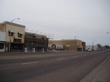
- Moreland, 아이다호 주
Moreland에 있는 회사
| Moreland, 아이다호 주의 면적 | 2.437mi² |
| 인구 | 1,320 |
| 남성 인구 | 682 (51.7%) |
| 여성 인구 | 638 (48.3%) |
| 1975부터 2015까지의 인구 변화 | +148.1% |
| 2000부터 2015까지의 인구 변화 | +12.4% |
| 연령 중앙값 | 33.1 |
| 남성 연령 중앙값 | 32.4 |
| 여성 연령 중앙값 | 33.9 |
| 지역번호 | 208 |
| 현지 시간 | 토요일 PM 10:51 |
| 시간대 | 미 산지 하계 표준시 |
| 위도 및 경도 | 43.22269° / -112.44248° |
| 우편 번호 | 83256 |
Moreland, 아이다호 주 - 지도
Moreland, 아이다호 주 인구
1975년부터 2015년까지| 데이터 | 1975 | 1990 | 2000 | 2015 |
|---|---|---|---|---|
| 인구 | 532 | 808 | 1,174 | 1,320 |
| 인구 밀도 | 218.3 / mi² | 331.6 / mi² | 481.7 / mi² | 541.6 / mi² |
2000부터 2015까지의 Moreland 인구 변화
2000년부터 2015년까지 12.4% 증가| 위치 | 1975 이후의 변화 | 1990 이후의 변화 | 2000 이후의 변화 |
|---|---|---|---|
| Moreland, 아이다호 주 | +148.1% | +63.4% | +12.4% |
| 아이다호 주 | +116.1% | +62.8% | +32% |
| 미국 | +46.9% | +27.2% | +13.7% |
Moreland, 아이다호 주 연령 중앙값
연령 중앙값: 33.1년| 위치 | 연령 중앙값 | 평균 연령 (여성) | 중간 나이 (남) |
|---|---|---|---|
| Moreland, 아이다호 주 | 33.1년 | 33.9년 | 32.4년 |
| 아이다호 주 | 34.9년 | 35.7년 | 34.1년 |
| 미국 | 37.4년 | 38.7년 | 36.1년 |
Moreland, 아이다호 주 인구 계통도
연령과 성별에 따른 인구| 나이 | 남성 | 여성 | 합계 |
|---|---|---|---|
| 5 세 미만 | 50 | 56 | 106 |
| 5-9 | 59 | 43 | 103 |
| 10-14 | 76 | 52 | 128 |
| 15-19 | 62 | 66 | 129 |
| 20-24 | 41 | 28 | 69 |
| 25-29 | 32 | 39 | 72 |
| 30-34 | 44 | 44 | 88 |
| 35-39 | 30 | 27 | 57 |
| 40-44 | 34 | 38 | 72 |
| 45-49 | 47 | 40 | 87 |
| 50-54 | 38 | 43 | 82 |
| 55-59 | 48 | 51 | 99 |
| 60-64 | 36 | 30 | 66 |
| 65-69 | 29 | 27 | 57 |
| 70-74 | 27 | 27 | 54 |
| 75-79 | 9 | 9 | 19 |
| 80-84 | 9 | 9 | 18 |
| 85 플러스 | 13 | 9 | 22 |
Moreland, 아이다호 주 인구 밀도
인구 밀도: 541.6 / mi²| 위치 | 인구 | 지역 | 인구 밀도 |
|---|---|---|---|
| Moreland, 아이다호 주 | 1,320 | 2.437mi² | 541.6 / mi² |
| 아이다호 주 | 1.7 백만 | 83,569.2mi² | 20.5 / mi² |
| 미국 | 321.6 백만 | 3,796,761.2mi² | 84.7 / mi² |
Moreland, 아이다호 주 과거 및 예상 인구
1890부터 2100까지의 추정 인구Sources:
1. JRC (European Commission's Joint Research Centre) work on the GHS built-up grid
2. CIESIN (Center for International Earth Science Information Network)
3. [링크] Klein Goldewijk, K., Beusen, A., Doelman, J., and Stehfest, E.: Anthropogenic land use estimates for the Holocene – HYDE 3.2, Earth Syst. Sci. Data, 9, 927–953, https://doi.org/10.5194/essd-9-927-2017, 2017.
인간 개발 지수 (HDI)
평균 수명, 교육 및 일인당 소득의 통계 복합 지수.Sources: [Link] Kummu, M., Taka, M. & Guillaume, J. Gridded global datasets for Gross Domestic Product and Human Development Index over 1990–2015. Sci Data 5, 180004 (2018) doi:10.1038/sdata.2018.4
Moreland, 아이다호 주 CO2 배출량
일인당 연간 이산화탄소 배출량 (CO2)| 위치 | 이산화탄소 배출 | 일인당 이산화탄소 배출량 | 이산화탄소 배출 강도 |
|---|---|---|---|
| Moreland, 아이다호 주 | 19,793tn | 15tn | 8,122 tn/mi² |
| 아이다호 주 | 30,791,275tn | 17.9tn | 368.5 tn/mi² |
| 미국 | 5,664,619,809tn | 17.6tn | 1,491 tn/mi² |
Moreland, 아이다호 주 CO2 배출량
| 2013 CO2 배출량(톤/년) | 19,793tn |
| 1인당 2013 CO2 배출량(톤/년) | 15tn |
| 2013 CO2 배출 정도(톤/mi²/년) |
자연 재해 위험
10 개 중 상대 위험| 가뭄 | 높음(10) |
| 지진 | 보통(4) |
* 특히 홍수 나 산사태와 관련된 위험은 전체 지역에 해당되지 않을 수 있습니다.
Sources: 1. Dilley, M., R.S. Chen, U. Deichmann, A.L. Lerner-Lam, M. Arnold, J. Agwe, P. Buys, O. Kjekstad, B. Lyon, and G. Yetman. 2005. Natural Disaster Hotspots: A Global Risk Analysis. Washington, D.C.: World Bank. https://doi.org/10.1596/0-8213-5930-4.
2. Center for Hazards and Risk Research - CHRR - Columbia University, Center for International Earth Science Information Network - CIESIN - Columbia University. 2005. Global Earthquake Hazard Distribution - Peak Ground Acceleration. Palisades, NY: NASA Socioeconomic Data and Applications Center (SEDAC). https://doi.org/10.7927/H4BZ63ZS.
3. Center for Hazards and Risk Research - CHRR - Columbia University, Center for International Earth Science Information Network - CIESIN - Columbia University, and International Research Institute for Climate and Society - IRI - Columbia University. 2005. Global Drought Hazard Frequency and Distribution. Palisades, NY: NASA Socioeconomic Data and Applications Center (SEDAC). https://doi.org/10.7927/H4VX0DFT.
최근 인근 지진
크기 3.0 이상| 날짜 | 시간 | 크기 | 거리 | 깊이 | 위치 | 링크 |
|---|---|---|---|---|---|---|
| 19. 4. 4. | AM 3:34 | 3.3 | 97.5km | 5,000m | 8km ENE of Soda Springs, Idaho | usgs.gov |
| 19. 4. 4. | AM 2:45 | 3.2 | 99.2km | 5,000m | 10km ENE of Soda Springs, Idaho | usgs.gov |
| 17. 9. 4. | PM 8:21 | 3.9 | 98.6km | 10,000m | 5km SE of Soda Springs, Idaho | usgs.gov |
| 17. 9. 4. | PM 3:10 | 3.1 | 99km | 6,000m | 9km ENE of Soda Springs, Idaho | usgs.gov |
| 17. 9. 4. | AM 12:34 | 3.4 | 99.2km | 10,000m | 8km E of Soda Springs, Idaho | usgs.gov |
| 17. 9. 3. | PM 5:05 | 3.6 | 97.9km | 10,000m | 7km E of Soda Springs, Idaho | usgs.gov |
| 17. 9. 3. | PM 2:10 | 3.4 | 97.7km | 10,000m | 5km ESE of Soda Springs, Idaho | usgs.gov |
| 17. 9. 3. | AM 1:24 | 3.2 | 98.1km | 5,650m | 8km ENE of Soda Springs, Idaho | usgs.gov |
| 17. 9. 2. | PM 7:16 | 3.2 | 98.6km | 10,000m | 8km E of Soda Springs, Idaho | usgs.gov |
| 17. 9. 2. | PM 6:02 | 3.7 | 96.2km | 11,440m | 9km ENE of Soda Springs, Idaho | usgs.gov |
Moreland, 아이다호 주 인근의 과거 지진 발생 찾기
가장 빠른 날짜 최신 날짜
크기 3.0 이상 크기 4.0 이상 크기 5.0 이상
우리의 데이터
이 페이지의 데이터는 공개적으로 사용 가능한 많은 도구와 리소스를 사용하여 추정됩니다. 보증없이 제공되며 부정확 한 내용이 포함될 수 있습니다. 자신의 책임하에 사용하십시오. 자세한 내용은 여기 를 참조하십시오.