- 세계
- »
- US
- »
- 인디애나 주
- »
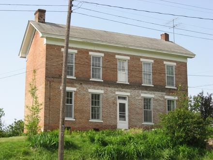
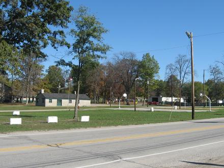
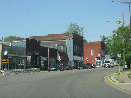
- Freelandville, 인디애나 주
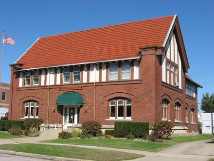
Freelandville에 있는 회사
산업
산업별 사업 분포 의료: 20.7%
쇼핑: 13.8%
전문 서비스: 13.8%
홈 서비스: 10.3%
산업: 6.9%
자동차: 6.9%
레스토랑: 6.9%
지역 서비스: 6.9%
금융 서비스: 6.9%
커뮤니티 & 정부: 6.9%
| Freelandville, 인디애나 주의 면적 | 5.57mi² |
| 인구 | 630 |
| 남성 인구 | 301 (47.8%) |
| 여성 인구 | 329 (52.2%) |
| 1975부터 2015까지의 인구 변화 | +48.9% |
| 2000부터 2015까지의 인구 변화 | -4.7% |
| 연령 중앙값 | 44.6 |
| 남성 연령 중앙값 | 40.6 |
| 여성 연령 중앙값 | 48.2 |
| 지역번호 | 812 |
| 현지 시간 | 일요일 AM 12:46 |
| 시간대 | 미 동부 하계 표준시 |
| 위도 및 경도 | 38.86477° / -87.30585° |
| 우편 번호 | 47535 |
Freelandville, 인디애나 주 - 지도
Freelandville, 인디애나 주 인구
1975년부터 2015년까지| 데이터 | 1975 | 1990 | 2000 | 2015 |
|---|---|---|---|---|
| 인구 | 423 | 538 | 661 | 630 |
| 인구 밀도 | 75.9 / mi² | 96.6 / mi² | 118.7 / mi² | 113.1 / mi² |
2000부터 2015까지의 Freelandville 인구 변화
2000년부터 2015년까지 4.7% 감소| 위치 | 1975 이후의 변화 | 1990 이후의 변화 | 2000 이후의 변화 |
|---|---|---|---|
| Freelandville, 인디애나 주 | +48.9% | +17.1% | -4.7% |
| 인디애나 주 | +33.4% | +18.8% | +8.8% |
| 미국 | +46.9% | +27.2% | +13.7% |
Freelandville, 인디애나 주 연령 중앙값
연령 중앙값: 44.6년| 위치 | 연령 중앙값 | 평균 연령 (여성) | 중간 나이 (남) |
|---|---|---|---|
| Freelandville, 인디애나 주 | 44.6년 | 48.2년 | 40.6년 |
| 인디애나 주 | 37년 | 38.2년 | 35.8년 |
| 미국 | 37.4년 | 38.7년 | 36.1년 |
Freelandville, 인디애나 주 인구 계통도
연령과 성별에 따른 인구| 나이 | 남성 | 여성 | 합계 |
|---|---|---|---|
| 5 세 미만 | 14 | 23 | 38 |
| 5-9 | 23 | 14 | 37 |
| 10-14 | 13 | 17 | 30 |
| 15-19 | 17 | 19 | 36 |
| 20-24 | 20 | 18 | 38 |
| 25-29 | 23 | 19 | 43 |
| 30-34 | 19 | 13 | 33 |
| 35-39 | 19 | 15 | 35 |
| 40-44 | 13 | 15 | 28 |
| 45-49 | 20 | 19 | 40 |
| 50-54 | 20 | 17 | 37 |
| 55-59 | 24 | 23 | 48 |
| 60-64 | 18 | 22 | 41 |
| 65-69 | 19 | 26 | 45 |
| 70-74 | 13 | 15 | 29 |
| 75-79 | 11 | 20 | 31 |
| 80-84 | 6 | 14 | 20 |
| 85 플러스 | 8 | 21 | 30 |
Freelandville, 인디애나 주 인구 밀도
인구 밀도: 113.1 / mi²| 위치 | 인구 | 지역 | 인구 밀도 |
|---|---|---|---|
| Freelandville, 인디애나 주 | 630 | 5.57mi² | 113.1 / mi² |
| 인디애나 주 | 6.6 백만 | 36,419.7mi² | 182.5 / mi² |
| 미국 | 321.6 백만 | 3,796,761.2mi² | 84.7 / mi² |
인간 개발 지수 (HDI)
평균 수명, 교육 및 일인당 소득의 통계 복합 지수.Sources: [Link] Kummu, M., Taka, M. & Guillaume, J. Gridded global datasets for Gross Domestic Product and Human Development Index over 1990–2015. Sci Data 5, 180004 (2018) doi:10.1038/sdata.2018.4
Freelandville, 인디애나 주 CO2 배출량
일인당 연간 이산화탄소 배출량 (CO2)| 위치 | 이산화탄소 배출 | 일인당 이산화탄소 배출량 | 이산화탄소 배출 강도 |
|---|---|---|---|
| Freelandville, 인디애나 주 | 12,768tn | 20.3tn | 2,292 tn/mi² |
| 인디애나 주 | 127,126,225tn | 19.1tn | 3,490 tn/mi² |
| 미국 | 5,664,619,809tn | 17.6tn | 1,491 tn/mi² |
Freelandville, 인디애나 주 CO2 배출량
| 2013 CO2 배출량(톤/년) | 12,768tn |
| 1인당 2013 CO2 배출량(톤/년) | 20.3tn |
| 2013 CO2 배출 정도(톤/mi²/년) |
자연 재해 위험
10 개 중 상대 위험| 홍수 | 높음(9) |
| 지진 | 보통(2.7) |
* 특히 홍수 나 산사태와 관련된 위험은 전체 지역에 해당되지 않을 수 있습니다.
Sources: 1. Dilley, M., R.S. Chen, U. Deichmann, A.L. Lerner-Lam, M. Arnold, J. Agwe, P. Buys, O. Kjekstad, B. Lyon, and G. Yetman. 2005. Natural Disaster Hotspots: A Global Risk Analysis. Washington, D.C.: World Bank. https://doi.org/10.1596/0-8213-5930-4.
2. Center for Hazards and Risk Research - CHRR - Columbia University, Center for International Earth Science Information Network - CIESIN - Columbia University. 2005. Global Earthquake Hazard Distribution - Peak Ground Acceleration. Palisades, NY: NASA Socioeconomic Data and Applications Center (SEDAC). https://doi.org/10.7927/H4BZ63ZS.
3. Center for Hazards and Risk Research - CHRR - Columbia University, Center for International Earth Science Information Network - CIESIN - Columbia University. 2005. Global Flood Hazard Frequency and Distribution. Palisades, NY: NASA Socioeconomic Data and Applications Center (SEDAC). https://doi.org/10.7927/H4668B3D.
최근 인근 지진
크기 3.0 이상| 날짜 | 시간 | 크기 | 거리 | 깊이 | 위치 | 링크 |
|---|---|---|---|---|---|---|
| 17. 9. 19. | AM 4:47 | 3.8 | 71.8km | 11,680m | 13km W of Mount Carmel, Illinois | usgs.gov |
| 17. 9. 8. | PM 9:15 | 3.06 | 72km | 11,760m | 13km W of Mount Carmel, Illinois | usgs.gov |
| 12. 11. 20. | PM 3:28 | 3.6 | 69km | 18,560m | 13km WNW of Mount Carmel, Illinois | usgs.gov |
| 12. 5. 10. | PM 3:54 | 3.1 | 14.9km | 10,700m | 13km WNW of Bicknell, Indiana | usgs.gov |
| 08. 7. 17. | PM 7:58 | 3.1 | 69.5km | 18,280m | 12km WNW of Mount Carmel, Illinois | usgs.gov |
| 08. 6. 5. | AM 12:13 | 3.4 | 65.4km | 16,239m | 8km WNW of Mount Carmel, Illinois | usgs.gov |
| 08. 4. 30. | PM 10:30 | 3.3 | 66.4km | 14,320m | 9km WNW of Mount Carmel, Illinois | usgs.gov |
| 08. 4. 25. | AM 10:31 | 3.7 | 67.5km | 12,980m | 10km WNW of Mount Carmel, Illinois | usgs.gov |
| 08. 4. 20. | PM 10:38 | 4 | 67.9km | 18,290m | 10km WNW of Mount Carmel, Illinois | usgs.gov |
| 08. 4. 18. | AM 8:14 | 4.7 | 66.6km | 15,460m | 10km WNW of Mount Carmel, Illinois | usgs.gov |
Freelandville, 인디애나 주 인근의 과거 지진 발생 찾기
가장 빠른 날짜 최신 날짜
크기 3.0 이상 크기 4.0 이상 크기 5.0 이상
우리의 데이터
이 페이지의 데이터는 공개적으로 사용 가능한 많은 도구와 리소스를 사용하여 추정됩니다. 보증없이 제공되며 부정확 한 내용이 포함될 수 있습니다. 자신의 책임하에 사용하십시오. 자세한 내용은 여기 를 참조하십시오.