- 세계
- »
- PH
- »
- 중부 비사야 지방
- »
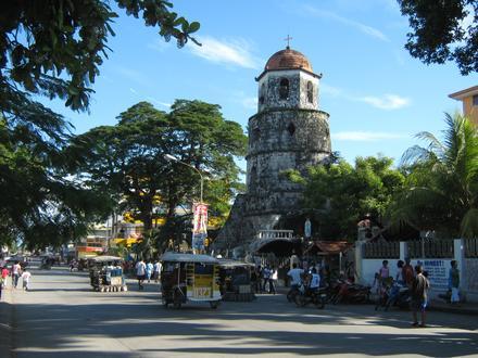
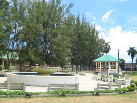
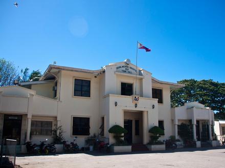
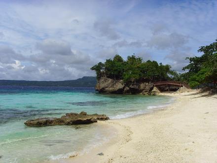
- Bacong, 중부 비사야 지방
Bacong에 있는 회사
산업
산업별 사업 분포 호텔 & 여행: 14.4%
쇼핑: 13.7%
음식: 13.1%
레스토랑: 10.8%
종교: 8.1%
홈 서비스: 6.6%
교육: 5.3%
기타: 28%
| Bacong, 중부 비사야 지방의 면적 | 40.3km² |
| 인구 | 35,092 |
| 남성 인구 | 17,722 (50.5%) |
| 여성 인구 | 17,370 (49.5%) |
| 1975부터 2015까지의 인구 변화 | +1,252.3% |
| 2000부터 2015까지의 인구 변화 | +95.5% |
| 연령 중앙값 | 25 |
| 남성 연령 중앙값 | 24.4 |
| 여성 연령 중앙값 | 25.7 |
| 현지 시간 | 일요일 PM 1:59 |
| 시간대 | 필리핀 표준시 |
| 위도 및 경도 | 9.2464° / 123.2956° |
| 우편 번호 | 6216 |
Bacong, 중부 비사야 지방 - 지도
Bacong, 중부 비사야 지방 인구
1975년부터 2015년까지| 데이터 | 1975 | 1990 | 2000 | 2015 |
|---|---|---|---|---|
| 인구 | 2,595 | 9,335 | 17,947 | 35,092 |
| 인구 밀도 | 64.4 / km² | 231.6 / km² | 445.3 / km² | 870.8 / km² |
2000부터 2015까지의 Bacong 인구 변화
2000년부터 2015년까지 95.5% 증가| 위치 | 1975 이후의 변화 | 1990 이후의 변화 | 2000 이후의 변화 |
|---|---|---|---|
| Bacong, 중부 비사야 지방 | +1,252.3% | +275.9% | +95.5% |
| 동네그로스 주 | +339.7% | +80.7% | +30.2% |
| 필리핀 | +146.5% | +63.3% | +29.5% |
Bacong, 중부 비사야 지방 연령 중앙값
연령 중앙값: 25년| 위치 | 연령 중앙값 | 평균 연령 (여성) | 중간 나이 (남) |
|---|---|---|---|
| Bacong, 중부 비사야 지방 | 25년 | 25.7년 | 24.4년 |
| 동네그로스 주 | 22.9년 | 23.3년 | 22.5년 |
| 필리핀 | 23.2년 | 23.6년 | 22.8년 |
Bacong, 중부 비사야 지방 인구 계통도
연령과 성별에 따른 인구| 나이 | 남성 | 여성 | 합계 |
|---|---|---|---|
| 5 세 미만 | 1,911 | 1,744 | 3,656 |
| 5-9 | 1,817 | 1,682 | 3,499 |
| 10-14 | 1,865 | 1,747 | 3,613 |
| 15-19 | 1,826 | 1,800 | 3,626 |
| 20-24 | 1,622 | 1,537 | 3,160 |
| 25-29 | 1,392 | 1,332 | 2,725 |
| 30-34 | 1,264 | 1,296 | 2,561 |
| 35-39 | 1,158 | 1,113 | 2,271 |
| 40-44 | 1,101 | 1,076 | 2,178 |
| 45-49 | 974 | 976 | 1,950 |
| 50-54 | 871 | 802 | 1,674 |
| 55-59 | 680 | 725 | 1,405 |
| 60-64 | 460 | 502 | 963 |
| 65-69 | 338 | 393 | 731 |
| 70-74 | 264 | 367 | 632 |
| 75-79 | 178 | 277 | 456 |
| 80-84 | 0 | 0 | 0 |
| 85 플러스 | 0 | 0 | 0 |
Bacong, 중부 비사야 지방 인구 밀도
인구 밀도: 870.8 / km²| 위치 | 인구 | 지역 | 인구 밀도 |
|---|---|---|---|
| Bacong, 중부 비사야 지방 | 35,092 | 40.3km² | 870.8 / km² |
| 동네그로스 주 | 1.3 백만 | 5,019.7km² | 261.7 / km² |
| 필리핀 | 96.6 백만 | 296,939.4km² | 325.3 / km² |
Bacong, 중부 비사야 지방 과거 및 예상 인구
1930부터 2100까지의 추정 인구Sources:
1. JRC (European Commission's Joint Research Centre) work on the GHS built-up grid
2. CIESIN (Center for International Earth Science Information Network)
3. [링크] Klein Goldewijk, K., Beusen, A., Doelman, J., and Stehfest, E.: Anthropogenic land use estimates for the Holocene – HYDE 3.2, Earth Syst. Sci. Data, 9, 927–953, https://doi.org/10.5194/essd-9-927-2017, 2017.
지역 코드
Bacong에 있는 사업체가 사용하는 지역 번호 비율 지역번호 35: 39.3%
지역번호 917: 14.3%
지역번호 93: 7.1%
지역번호 947: 7.1%
지역번호 2: 3.6%
지역번호 34: 3.6%
지역번호 905: 3.6%
지역번호 906: 3.6%
지역번호 908: 3.6%
지역번호 916: 3.6%
지역번호 919: 3.6%
지역번호 926: 3.6%
지역번호 999: 3.6%
인간 개발 지수 (HDI)
평균 수명, 교육 및 일인당 소득의 통계 복합 지수.Sources: [Link] Kummu, M., Taka, M. & Guillaume, J. Gridded global datasets for Gross Domestic Product and Human Development Index over 1990–2015. Sci Data 5, 180004 (2018) doi:10.1038/sdata.2018.4
Bacong, 중부 비사야 지방 CO2 배출량
일인당 연간 이산화탄소 배출량 (CO2)| 위치 | 이산화탄소 배출 | 일인당 이산화탄소 배출량 | 이산화탄소 배출 강도 |
|---|---|---|---|
| Bacong, 중부 비사야 지방 | 40,844tn | 1.16tn | 1,013 tn/km² |
| 동네그로스 주 | 1,425,224tn | 1.08tn | 283.9 tn/km² |
| 필리핀 | 104,920,564tn | 1.09tn | 353.3 tn/km² |
Bacong, 중부 비사야 지방 CO2 배출량
| 2013 CO2 배출량(톤/년) | 40,844tn |
| 1인당 2013 CO2 배출량(톤/년) | 1.16tn |
| 2013 CO2 배출 정도(톤/km²/년) | 1,013 tn/km² |
자연 재해 위험
10 개 중 상대 위험| 산사태 | 높음(7) |
| 집진 장치 | 높음(8) |
| 가뭄 | 보통(5) |
| 홍수 | 보통(4) |
| 지진 | 보통(6) |
* 특히 홍수 나 산사태와 관련된 위험은 전체 지역에 해당되지 않을 수 있습니다.
Sources: 1. Dilley, M., R.S. Chen, U. Deichmann, A.L. Lerner-Lam, M. Arnold, J. Agwe, P. Buys, O. Kjekstad, B. Lyon, and G. Yetman. 2005. Natural Disaster Hotspots: A Global Risk Analysis. Washington, D.C.: World Bank. https://doi.org/10.1596/0-8213-5930-4.
2. Center for Hazards and Risk Research - CHRR - Columbia University, Center for International Earth Science Information Network - CIESIN - Columbia University. 2005. Global Flood Hazard Frequency and Distribution. Palisades, NY: NASA Socioeconomic Data and Applications Center (SEDAC). https://doi.org/10.7927/H4668B3D.
3. Center for Hazards and Risk Research - CHRR - Columbia University, Center for International Earth Science Information Network - CIESIN - Columbia University, and Norwegian Geotechnical Institute - NGI. 2005. Global Landslide Hazard Distribution. Palisades, NY: NASA Socioeconomic Data and Applications Center (SEDAC). https://doi.org/10.7927/H4P848VZ.
4. Center for Hazards and Risk Research - CHRR - Columbia University, Center for International Earth Science Information Network - CIESIN - Columbia University, and International Research Institute for Climate and Society - IRI - Columbia University. 2005. Global Drought Hazard Frequency and Distribution. Palisades, NY: NASA Socioeconomic Data and Applications Center (SEDAC). https://doi.org/10.7927/H4VX0DFT.
5. Center for Hazards and Risk Research - CHRR - Columbia University, Center for International Earth Science Information Network - CIESIN - Columbia University, International Bank for Reconstruction and Development - The World Bank, and United Nations Environment Programme Global Resource Information Database Geneva - UNEP/GRID-Geneva. 2005. Global Cyclone Hazard Frequency and Distribution. Palisades, NY: NASA Socioeconomic Data and Applications Center (SEDAC). https://doi.org/10.7927/H4CZ353K.
6. Center for Hazards and Risk Research - CHRR - Columbia University, Center for International Earth Science Information Network - CIESIN - Columbia University. 2005. Global Earthquake Hazard Distribution - Peak Ground Acceleration. Palisades, NY: NASA Socioeconomic Data and Applications Center (SEDAC). https://doi.org/10.7927/H4BZ63ZS.
최근 인근 지진
크기 3.0 이상| 날짜 | 시간 | 크기 | 거리 | 깊이 | 위치 | 링크 |
|---|---|---|---|---|---|---|
| 18. 12. 24. | AM 6:43 | 4.7 | 58.9km | 35,000m | 9km E of Tinaogan, Philippines | usgs.gov |
| 18. 12. 8. | PM 9:10 | 4.5 | 29.3km | 10,000m | 2km SE of Pamplona, Philippines | usgs.gov |
| 18. 6. 5. | AM 3:49 | 4.2 | 10.2km | 10,000m | 5km SW of Valencia, Philippines | usgs.gov |
| 18. 1. 26. | PM 2:21 | 4.3 | 21.4km | 70,390m | 12km ESE of Zamboanguita, Philippines | usgs.gov |
| 16. 12. 30. | AM 7:01 | 4.1 | 61.7km | 69,420m | 9km SSW of Malabugas, Philippines | usgs.gov |
| 15. 9. 5. | AM 6:49 | 4.6 | 40.7km | 63,780m | 17km SSW of Lazi, Philippines | usgs.gov |
| 15. 9. 1. | AM 8:11 | 4.7 | 45.6km | 96,970m | 6km ESE of Lazi, Philippines | usgs.gov |
| 15. 1. 18. | AM 4:34 | 4.6 | 56.1km | 87,270m | 10km ESE of Alcoy, Philippines | usgs.gov |
| 14. 11. 24. | AM 5:46 | 4.4 | 36.1km | 157,650m | 3km WSW of Novallas, Philippines | usgs.gov |
| 13. 12. 2. | PM 8:24 | 4.3 | 59.4km | 10,000m | 4km WNW of Duljo, Philippines | usgs.gov |
Bacong, 중부 비사야 지방 인근의 과거 지진 발생 찾기
가장 빠른 날짜 최신 날짜
크기 3.0 이상 크기 4.0 이상 크기 5.0 이상
우리의 데이터
이 페이지의 데이터는 공개적으로 사용 가능한 많은 도구와 리소스를 사용하여 추정됩니다. 보증없이 제공되며 부정확 한 내용이 포함될 수 있습니다. 자신의 책임하에 사용하십시오. 자세한 내용은 여기 를 참조하십시오.