- 세계
- »
- BZ
- »
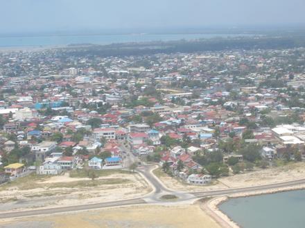
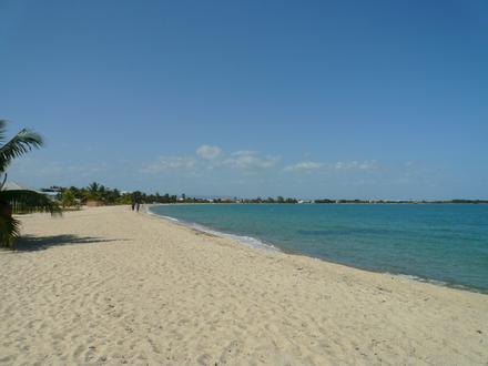
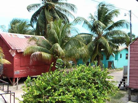
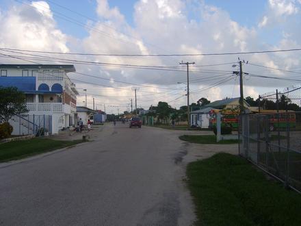
- Hopkins, 스탠크리크 구
Hopkins에 있는 회사
산업
산업별 사업 분포 호텔 & 여행: 42.4%
레스토랑: 26.5%
음식: 8.2%
쇼핑: 5.8%
기타: 17.1%
| Hopkins, 스탠크리크 구의 면적 | 1.727km² |
| 인구 | 1,385 |
| 1975부터 2015까지의 인구 변화 | +119.8% |
| 2000부터 2015까지의 인구 변화 | +38.4% |
| 현지 시간 | 화요일 PM 5:41 |
| 시간대 | 미 중부 표준시 |
| 위도 및 경도 | 16.86308° / -88.28437° |
Hopkins, 스탠크리크 구 - 지도
Hopkins, 스탠크리크 구 인구
1975년부터 2015년까지| 데이터 | 1975 | 1990 | 2000 | 2015 |
|---|---|---|---|---|
| 인구 | 630 | 921 | 1,001 | 1,385 |
| 인구 밀도 | 364.7 / km² | 533.2 / km² | 579.5 / km² | 801.8 / km² |
2000부터 2015까지의 Hopkins 인구 변화
2000년부터 2015년까지 38.4% 증가| 위치 | 1975 이후의 변화 | 1990 이후의 변화 | 2000 이후의 변화 |
|---|---|---|---|
| Hopkins, 스탠크리크 구 | +119.8% | +50.4% | +38.4% |
| 스탠크리크 구 | +152.8% | +88.5% | +40.3% |
| 벨리즈 | +172.3% | +92.8% | +45.3% |
Hopkins, 스탠크리크 구 인구 밀도
인구 밀도: 801.8 / km²| 위치 | 인구 | 지역 | 인구 밀도 |
|---|---|---|---|
| Hopkins, 스탠크리크 구 | 1,385 | 1.727km² | 801.8 / km² |
| 스탠크리크 구 | 42,510 | 2,466.5km² | 17.2 / km² |
| 벨리즈 | 349,968 | 22,282.9km² | 15.7 / km² |
Hopkins, 스탠크리크 구 과거 및 예상 인구
1700부터 2100까지의 추정 인구Sources:
1. JRC (European Commission's Joint Research Centre) work on the GHS built-up grid
2. CIESIN (Center for International Earth Science Information Network)
3. [링크] Klein Goldewijk, K., Beusen, A., Doelman, J., and Stehfest, E.: Anthropogenic land use estimates for the Holocene – HYDE 3.2, Earth Syst. Sci. Data, 9, 927–953, https://doi.org/10.5194/essd-9-927-2017, 2017.
Hopkins, 스탠크리크 구의 가격별 사업체 분포
보통: 73.3%
저렴: 13.3%
비싼: 13.3%
인간 개발 지수 (HDI)
평균 수명, 교육 및 일인당 소득의 통계 복합 지수.Sources: [Link] Kummu, M., Taka, M. & Guillaume, J. Gridded global datasets for Gross Domestic Product and Human Development Index over 1990–2015. Sci Data 5, 180004 (2018) doi:10.1038/sdata.2018.4
Hopkins, 스탠크리크 구 CO2 배출량
일인당 연간 이산화탄소 배출량 (CO2)| 위치 | 이산화탄소 배출 | 일인당 이산화탄소 배출량 | 이산화탄소 배출 강도 |
|---|---|---|---|
| Hopkins, 스탠크리크 구 | 1,863tn | 1.35tn | 1,078 tn/km² |
| 스탠크리크 구 | 113,041tn | 2.66tn | 45.8 tn/km² |
| 벨리즈 | 920,961tn | 2.63tn | 41.3 tn/km² |
Hopkins, 스탠크리크 구 CO2 배출량
| 2013 CO2 배출량(톤/년) | 1,863tn |
| 1인당 2013 CO2 배출량(톤/년) | 1.35tn |
| 2013 CO2 배출 정도(톤/km²/년) | 1,078 tn/km² |
자연 재해 위험
10 개 중 상대 위험| 집진 장치 | 높음(8) |
| 홍수 | 보통(4) |
| 지진 | 보통(4) |
* 특히 홍수 나 산사태와 관련된 위험은 전체 지역에 해당되지 않을 수 있습니다.
Sources: 1. Dilley, M., R.S. Chen, U. Deichmann, A.L. Lerner-Lam, M. Arnold, J. Agwe, P. Buys, O. Kjekstad, B. Lyon, and G. Yetman. 2005. Natural Disaster Hotspots: A Global Risk Analysis. Washington, D.C.: World Bank. https://doi.org/10.1596/0-8213-5930-4.
2. Center for Hazards and Risk Research - CHRR - Columbia University, Center for International Earth Science Information Network - CIESIN - Columbia University. 2005. Global Earthquake Hazard Distribution - Peak Ground Acceleration. Palisades, NY: NASA Socioeconomic Data and Applications Center (SEDAC). https://doi.org/10.7927/H4BZ63ZS.
3. Center for Hazards and Risk Research - CHRR - Columbia University, Center for International Earth Science Information Network - CIESIN - Columbia University, International Bank for Reconstruction and Development - The World Bank, and United Nations Environment Programme Global Resource Information Database Geneva - UNEP/GRID-Geneva. 2005. Global Cyclone Hazard Frequency and Distribution. Palisades, NY: NASA Socioeconomic Data and Applications Center (SEDAC). https://doi.org/10.7927/H4CZ353K.
4. Center for Hazards and Risk Research - CHRR - Columbia University, Center for International Earth Science Information Network - CIESIN - Columbia University. 2005. Global Flood Hazard Frequency and Distribution. Palisades, NY: NASA Socioeconomic Data and Applications Center (SEDAC). https://doi.org/10.7927/H4668B3D.
최근 인근 지진
크기 3.0 이상| 날짜 | 시간 | 크기 | 거리 | 깊이 | 위치 | 링크 |
|---|---|---|---|---|---|---|
| 16. 12. 30. | AM 3:23 | 4.4 | 91km | 22,600m | 38km NNE of Baja Mar, Honduras | usgs.gov |
| 13. 6. 2. | AM 1:33 | 4.3 | 74.2km | 10,000m | offshore Honduras | usgs.gov |
| 09. 10. 26. | AM 4:32 | 4.2 | 89.5km | 10,000m | offshore Honduras | usgs.gov |
| 09. 5. 28. | PM 9:38 | 4.3 | 89.9km | 10,000m | offshore Honduras | usgs.gov |
| 97. 7. 6. | PM 1:13 | 6.1 | 87.4km | 33,000m | offshore Honduras | usgs.gov |
| 92. 2. 15. | AM 10:47 | 4.5 | 89.1km | 33,000m | offshore Guatemala | usgs.gov |
| 85. 6. 27. | PM 5:46 | 4.7 | 55.7km | 33,000m | offshore Belize | usgs.gov |
우리의 데이터
이 페이지의 데이터는 공개적으로 사용 가능한 많은 도구와 리소스를 사용하여 추정됩니다. 보증없이 제공되며 부정확 한 내용이 포함될 수 있습니다. 자신의 책임하에 사용하십시오. 자세한 내용은 여기 를 참조하십시오.