- 세계
- »
- AL
- »
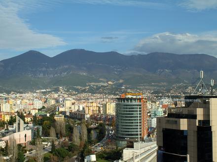
- Paskuqan, 티라나 주
Paskuqan에 있는 회사
| Paskuqan, 티라나 주의 면적 | 14.1km² |
| 인구 | 58,741 |
| 남성 인구 | 29,049 (49.5%) |
| 여성 인구 | 29,692 (50.5%) |
| 1975부터 2015까지의 인구 변화 | +3,056.4% |
| 2000부터 2015까지의 인구 변화 | +84.2% |
| 연령 중앙값 | 32.2 |
| 남성 연령 중앙값 | 31.8 |
| 여성 연령 중앙값 | 32.6 |
| 현지 시간 | 수요일 AM 1:41 |
| 시간대 | 중부유럽 하계 표준시 |
| 위도 및 경도 | 41.35389° / 19.80667° |
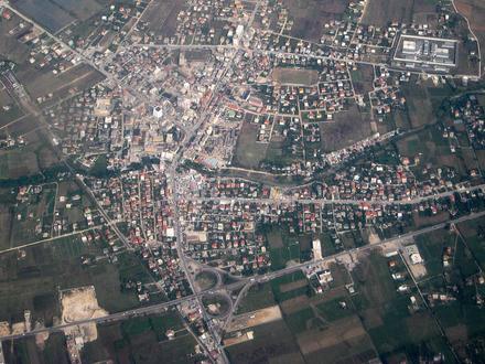
Paskuqan, 티라나 주 - 지도
Paskuqan, 티라나 주 인구
1975년부터 2015년까지| 데이터 | 1975 | 1990 | 2000 | 2015 |
|---|---|---|---|---|
| 인구 | 1,861 | 10,576 | 31,889 | 58,741 |
| 인구 밀도 | 131.8 / km² | 749.0 / km² | 2,258 / km² | 4,159 / km² |
2000부터 2015까지의 Paskuqan 인구 변화
2000년부터 2015년까지 84.2% 증가| 위치 | 1975 이후의 변화 | 1990 이후의 변화 | 2000 이후의 변화 |
|---|---|---|---|
| Paskuqan, 티라나 주 | +3,056.4% | +455.4% | +84.2% |
| 티라나 주 | +548.2% | +100.3% | +49.2% |
| 알바니아 | +19.9% | -11.7% | -7.2% |
Paskuqan, 티라나 주 연령 중앙값
연령 중앙값: 32.2년| 위치 | 연령 중앙값 | 평균 연령 (여성) | 중간 나이 (남) |
|---|---|---|---|
| Paskuqan, 티라나 주 | 32.2년 | 32.6년 | 31.8년 |
| 티라나 주 | 32.2년 | 32.6년 | 31.8년 |
| 알바니아 | 33.5년 | 34.7년 | 32.3년 |
Paskuqan, 티라나 주 인구 계통도
연령과 성별에 따른 인구| 나이 | 남성 | 여성 | 합계 |
|---|---|---|---|
| 5 세 미만 | 1,904 | 1,743 | 3,647 |
| 5-9 | 1,945 | 1,780 | 3,725 |
| 10-14 | 2,279 | 2,123 | 4,402 |
| 15-19 | 2,667 | 2,764 | 5,432 |
| 20-24 | 2,796 | 2,972 | 5,768 |
| 25-29 | 2,266 | 2,389 | 4,656 |
| 30-34 | 1,903 | 2,046 | 3,950 |
| 35-39 | 1,834 | 1,934 | 3,768 |
| 40-44 | 1,869 | 1,965 | 3,834 |
| 45-49 | 1,874 | 1,937 | 3,811 |
| 50-54 | 1,901 | 1,915 | 3,817 |
| 55-59 | 1,637 | 1,676 | 3,313 |
| 60-64 | 1,310 | 1,301 | 2,611 |
| 65-69 | 989 | 985 | 1,975 |
| 70-74 | 853 | 896 | 1,749 |
| 75-79 | 584 | 636 | 1,221 |
| 80-84 | 293 | 378 | 672 |
| 85 플러스 | 146 | 253 | 399 |
Paskuqan, 티라나 주 인구 밀도
인구 밀도: 4,159 / km²| 위치 | 인구 | 지역 | 인구 밀도 |
|---|---|---|---|
| Paskuqan, 티라나 주 | 58,741 | 14.1km² | 4,159 / km² |
| 티라나 주 | 878,002 | 1,647.8km² | 532.8 / km² |
| 알바니아 | 2.9 백만 | 28,671.4km² | 100.6 / km² |
Paskuqan, 티라나 주 과거 및 예상 인구
1960부터 2100까지의 추정 인구Sources:
1. JRC (European Commission's Joint Research Centre) work on the GHS built-up grid
2. CIESIN (Center for International Earth Science Information Network)
3. [링크] Klein Goldewijk, K., Beusen, A., Doelman, J., and Stehfest, E.: Anthropogenic land use estimates for the Holocene – HYDE 3.2, Earth Syst. Sci. Data, 9, 927–953, https://doi.org/10.5194/essd-9-927-2017, 2017.
인간 개발 지수 (HDI)
평균 수명, 교육 및 일인당 소득의 통계 복합 지수.Sources: [Link] Kummu, M., Taka, M. & Guillaume, J. Gridded global datasets for Gross Domestic Product and Human Development Index over 1990–2015. Sci Data 5, 180004 (2018) doi:10.1038/sdata.2018.4
Paskuqan, 티라나 주 CO2 배출량
일인당 연간 이산화탄소 배출량 (CO2)| 위치 | 이산화탄소 배출 | 일인당 이산화탄소 배출량 | 이산화탄소 배출 강도 |
|---|---|---|---|
| Paskuqan, 티라나 주 | 198,901tn | 3.39tn | 14,085 tn/km² |
| 티라나 주 | 2,690,800tn | 3.06tn | 1,633 tn/km² |
| 알바니아 | 7,341,173tn | 2.55tn | 256 tn/km² |
Paskuqan, 티라나 주 CO2 배출량
| 2013 CO2 배출량(톤/년) | 198,901tn |
| 1인당 2013 CO2 배출량(톤/년) | 3.39tn |
| 2013 CO2 배출 정도(톤/km²/년) | 14,085 tn/km² |
자연 재해 위험
10 개 중 상대 위험| 산사태 | 보통(6) |
| 지진 | 보통(6) |
* 특히 홍수 나 산사태와 관련된 위험은 전체 지역에 해당되지 않을 수 있습니다.
Sources: 1. Dilley, M., R.S. Chen, U. Deichmann, A.L. Lerner-Lam, M. Arnold, J. Agwe, P. Buys, O. Kjekstad, B. Lyon, and G. Yetman. 2005. Natural Disaster Hotspots: A Global Risk Analysis. Washington, D.C.: World Bank. https://doi.org/10.1596/0-8213-5930-4.
2. Center for Hazards and Risk Research - CHRR - Columbia University, Center for International Earth Science Information Network - CIESIN - Columbia University. 2005. Global Earthquake Hazard Distribution - Peak Ground Acceleration. Palisades, NY: NASA Socioeconomic Data and Applications Center (SEDAC). https://doi.org/10.7927/H4BZ63ZS.
3. Center for Hazards and Risk Research - CHRR - Columbia University, Center for International Earth Science Information Network - CIESIN - Columbia University, and Norwegian Geotechnical Institute - NGI. 2005. Global Landslide Hazard Distribution. Palisades, NY: NASA Socioeconomic Data and Applications Center (SEDAC). https://doi.org/10.7927/H4P848VZ.
최근 인근 지진
크기 3.0 이상| 날짜 | 시간 | 크기 | 거리 | 깊이 | 위치 | 링크 |
|---|---|---|---|---|---|---|
| 17. 6. 23. | AM 7:15 | 4.1 | 13.5km | 25,920m | 9km SE of Kruje, Albania | usgs.gov |
| 09. 11. 17. | PM 7:16 | 4.3 | 16.6km | 19,300m | Albania | usgs.gov |
| 08. 6. 25. | AM 11:05 | 4 | 15km | 11,000m | Albania | usgs.gov |
| 08. 5. 19. | PM 2:28 | 4 | 12.8km | 14,400m | Albania | usgs.gov |
| 08. 3. 15. | AM 4:10 | 3.1 | 10.6km | 2,600m | Albania | usgs.gov |
| 07. 11. 24. | AM 12:46 | 3.6 | 21.5km | 14,700m | Albania | usgs.gov |
| 07. 4. 20. | AM 10:55 | 3.4 | 20.3km | 11,000m | Albania | usgs.gov |
| 06. 5. 8. | AM 6:01 | 3.3 | 13.5km | 2,800m | Albania | usgs.gov |
| 05. 12. 25. | PM 9:53 | 4.1 | 17.3km | 2,000m | Albania | usgs.gov |
| 05. 9. 15. | AM 8:55 | 3.4 | 10.5km | 5,300m | Albania | usgs.gov |
Paskuqan, 티라나 주 인근의 과거 지진 발생 찾기
가장 빠른 날짜 최신 날짜
크기 3.0 이상 크기 4.0 이상 크기 5.0 이상

우리의 데이터
이 페이지의 데이터는 공개적으로 사용 가능한 많은 도구와 리소스를 사용하여 추정됩니다. 보증없이 제공되며 부정확 한 내용이 포함될 수 있습니다. 자신의 책임하에 사용하십시오. 자세한 내용은 여기 를 참조하십시오.